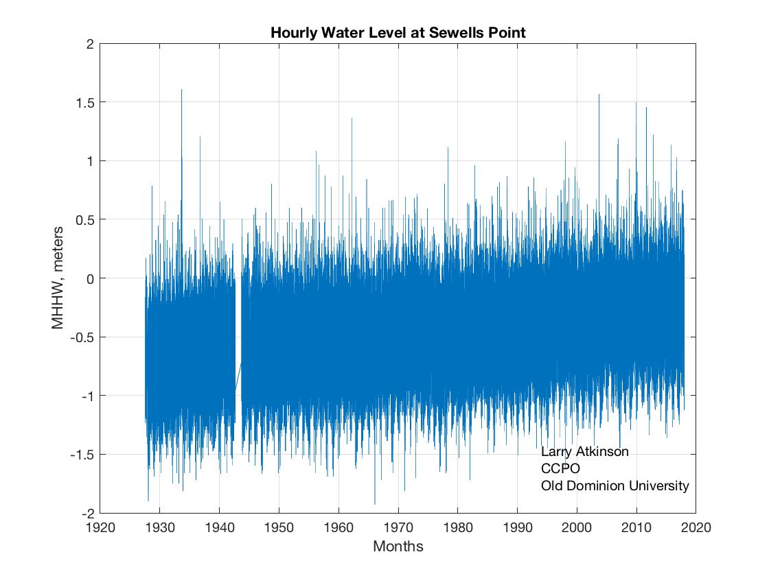
Wednesday, December 26, 2018

Maryland Updates its Sea Level Rise Projections


From the report 

"The new projections do not differ substantially from those provided in 2013, but the probability distributions can be useful in planning and regulation, infrastructure siting and design, estimation of changes in tidal range and storm surge, developing inundation mapping tools, and adaptation strategies for high-tide flooding and saltwater intrusion."


Wednesday, May 2, 2018

NASA SLR Data Tool

NASA now has the following

The NASA Sea Level Change Data Analysis Tool (DAT) has been designed to allow for quick-look comparisons and analysis of NASA datasets of sea level change. The datasets range from sea level observations, to ice observations, to model output to quickly study anomalies and get immediate results on potential relations between different datasets. For computational reasons, all data have been interpolated to a 1x1 degree grid. Full datasets can be download through the database for further analysis.


Caution - this data is probably not meant to be used in coastal waters. 

Tuesday, January 2, 2018

Sea Level Rise for Hampton Roads 2017

Sea Water Levels at Sewells Point, VA


With the end of the year, it is a good time to recap the data we have on flooding events and sea level rise for the Hampton Roads region. 


Hourly Data at Sewells Point


Average Annual Sea Level at Sewells Point


The variability is caused by interannual processes like el Nino, la Nina and other ocean cycles. 


10 Year moving average at Sewells Point


Hours per year of Nuisance Flooding


Return Period of Flooding Events


Rate of Sea Level Rise 


The trend has increased from 4.59 to 4.61mm/year since last year.

The past year - 2017


2017 Compared to other years by month


You will notice that the highest water levels during any year are often in September. This is because the ocean waters are warmest then and they have expanded - making sea level higher. This is a seasonal effect.